

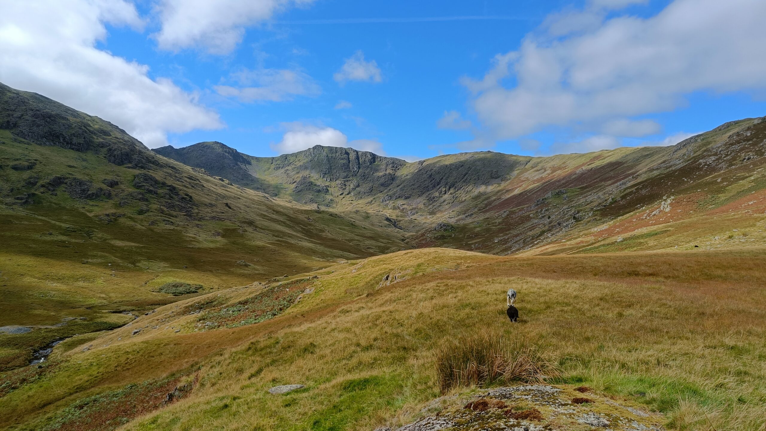
Nature Recovery in The Lake District
Imagine seeing nature’s recovery unfold from a bird’s-eye view. That is the new reality with aerial filming using drones, a powerful tool for watching our environment change. Drones offer a special way to see how landscapes transform over time, especially in wild, important places. This unique perspective helps us show the hard work behind conservation. We can now visualise big changes that might be hard to spot from the ground.
This story takes us to the heart of the Lake District. Here nature recovery and other conservation techniques are been employed. What visible impacts are these efforts having on the land? What difference are being made for nature? Drone footage helps answer these important questions.
The Power of Aerial Perspective in Conservation
Capturing Change: Drone Technology and Environmental Monitoring
Drones give a high-resolution, quiet way to watch ecological shifts. They fly over areas, collecting pictures and videos without disturbing wildlife. This technology allows us to see the land in amazing detail, from vast forests to tiny streams. Can even collect special data like multispectral imagery, which reveals plant health.
Compared to old ways of surveying by foot, drones cover much more ground. They reach tough spots easily, saving time and resources. This means we get a bigger, clearer picture of environmental changes. It helps conservationists make better choices for the future.
A Landscape in Transition
Areas of land in The Lake District are a key examples for conservation work with beautiful fells and clear streams.
Unveiling Nature Recovery Techniques
Habitat Restoration and Biodiversity Enhancement
The aim is to make habitats better and bring back more types of plants and animals. The drone footage truly captures these changes.
Planting native trees and letting nature replant its own trees too. From above, you can see new patches of woodland slowly growing. This helps connect different habitats, making it easier for wildlife to move around. Also working on peatland restoration. Rewetting these vital bogs helps store carbon and creates homes for unique plants. Drone views show how these areas become wetter and healthier. Also manage grasslands, turning them into vibrant wildflower meadows. The colours and patterns of these new meadows look spectacular from the air.
Watercourse Management and Riparian Zone Health
Drone footage is perfect for checking on rivers and streams within nature recovery projects. Healthy waterways mean healthy ecosystems around them. This aerial view helps us see how our efforts are paying off.
Restoring rivers to their natural, winding paths. This slows down water flow and creates more varied habitats for fish and insects. Drone imagery clearly shows rivers returning to their original, meandering forms. Also stabilise riverbanks by planting native plants. This stops soil erosion and makes a greener edge for the water. The drone can track how well these new plants take hold along the riverbanks.
Measuring the Impact: What the Drone Footage Reveals
Quantifying Ecological Improvements
Drone data gives a clear way to measure the success of our conservation work. It turns observations into real numbers and trends. What kind of improvements are been seen?
Analyse drone images to track changes in plant cover and how dense it is. Are the new trees growing well? Are meadows getting richer with more plants? Aerial views also show us how connected habitats are becoming. Wildlife corridors let animals travel safely across the landscape. We can even spot visual signs of better water quality. Clearer water or fewer algae blooms can be seen from above.
Biodiversity Indicators Visible from Above
Drones can also capture signs of increased biodiversity. These clues tell us that the nature recovery efforts are attracting more life. What can we see from the sky?
Can observe bird flight patterns. More birds, or new types of birds, suggest a healthier environment. Sometimes, new nesting sites become visible. Could see shifts in mammal grazing patterns, which means animals are using the improved habitat. Even changes in insect activity, like more pollinators in wildflower meadows, can have visual cues from a drone’s perspective. It all paints a picture of a thriving ecosystem.
Voices from the Field
The Nature Recovery work in The Lake District is a big job. Drones show things that would never be seen never on the ground.
Drone technology has changed how we monitor our projects. It saves us so much time and gives such precise data.
Practical Application: Drone Filming for Conservation Projects
Best Practices for Drone Deployment in Natural Landscapes
Thinking about using drones for conservation? You need to plan carefully. Always get necessary permissions before flying, especially in protected areas. Look into local regulations and follow ethical guidelines to protect wildlife. This often means flying at certain heights or avoiding sensitive times like nesting season.
For filming, use the right camera settings for clear images and steady video. Plan your flight paths to cover important areas effectively. Repeating the same flight path over time helps track changes. Use GPS coordinates for accuracy.
Communicating Conservation Success Through Visuals
Drone footage is an amazing tool for sharing your conservation story. It makes complex information easy to understand. How can you use it effectively?
Use drone footage to create compelling narratives. Show the “before and after” of your projects. Highlight the hard work and the positive results. Share these videos and images on social media and your website. People love seeing nature’s comeback from a new angle. This visual content is also perfect for educational outreach. It helps raise public awareness and encourages support for conservation.
Post note
Information for this article gathered from internet search for material and articles on line.


Recent Comments