

3D Mapping & Survey at Skylark Aerial Photography.
50% of our work is now involved with inspection and survey. A drone can carry out a mapping exercise so much more effectively than a person on the ground. What could take 5 hours out on the fells will take only around 40 minutes with a drone.
Carrying out the research prior to the mapping is vital. A visit to the site and what is required by the client. Using the appropriate software the drone is programmed to carry out a sector by sector aerial survey. Taking stills at set interval with a 75% overlap at 50m works very well for open ground, adjusted to 85% overlap for trees and buildings. The programme will calculate the route and number of stills required.
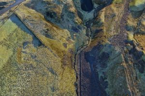
Battery life is calculated and an auto return to change the battery when required. The exposure is set at auto for mapping.
The work begins with the processing. Be warned a suitable high end processor is required to carry out the modelling.
3D Mapping & Survey at Skylark Aerial Photography
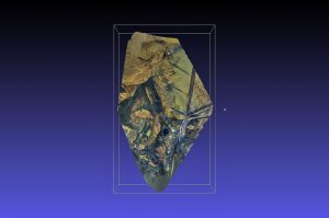
We use two platforms, its really what you get used to and what outputs are required. The first platform sets the drone up, takes the stills and processors the images. Outputs from these are then used in the 2nd platform which carries out the 3D modelling.
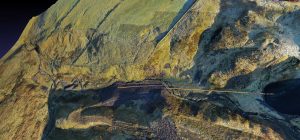
The data delivered is so powerful, that distances down to mm and gradients can be calculated by simply placing cross hairs on the model. Volumectric data can be derived. This enables volume of water in a beck or lake to be calculated. Material used to landscape can also be calculated.
3D Mapping & Survey at Skylark Aerial Photography
A very important requirement are ground control points, placed at set points on the area that needs to be surveyed. These proved exact datum points to form the basis of the 3D modelling. These points need to be seen by the drone and still taken when exactly overhead.
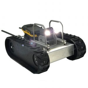
In 2020 we shall be investing in a tracked robot system to allow survey and inspection in confined spaces, pipes and hazardous areas. These robot platforms will also be able to provide stills for 3D modelling, LIDAR, thermal imaging, gas analysis.
Please do contact Skylark Aerial Photography to provide your complete survey or inspection requirements for 2020.


Recent Comments