

The Unpaved Divide: Should 4x4s Be Allowed on Green Lanes in the English Lake District?
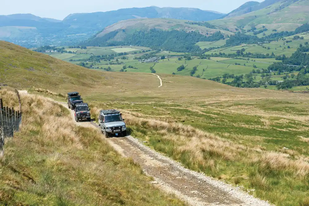
Picture this: a quiet green lane winds through misty fells, where sheep graze and wildflowers nod in the breeze. Suddenly, the peace shatters as a 4×4 rumbles past, kicking up mud and stones. This clash captures the heart of a heated debate in the Lake District.
Green lanes here are unclassified county roads, often called Byways Open to All Traffic or BOATs. They snake through the UNESCO World Heritage Site of the Lake District National Park, a place famed for its lakes, mountains, and timeless beauty. These paths let hikers, cyclists, and drivers share the landscape, but not without tension.
At the core lies a tough question: can we keep green lanes open to 4x4s while safeguarding the area’s fragile environment and history? On one side, enthusiasts push for access rights and tradition. On the other, conservationists warn of lasting harm. This article explores both views, the laws at play, and paths to balance it all.
The Legal Landscape: Understanding BOATs in the Lake District
Defining BOATs (Byways Open to All Traffic)
BOATs stand for Byways Open to All Traffic. They differ from footpaths, meant just for walkers, and bridleways, open to horses and bikes too. Under UK law, these routes allow motor vehicles like 4x4s, as long as they stick to the path.
This status comes from old rights of way laws. It means drivers have legal access, but only if the route is marked as a BOAT on official maps. In the Lake District, many such lanes trace back centuries, used by packhorses and carts.
Yet, this openness sparks issues. Not all lanes suit heavy vehicles, and misuse can lead to fines or closures. The key is knowing your rights—and limits—before heading out.
The Effect of Definitive Maps and Recent Legislation
Definitive maps show public rights of way in each county. In Cumbria, which covers the Lake District, these maps decide if a green lane qualifies as a BOAT. If it’s not listed, vehicles might face bans.
Recent laws, like the Wildlife and Countryside Act, push for reviews. Local councils use them to add or remove routes based on evidence. In the LDNP, some TROs already restrict 4x4s on wet days to curb damage.
One example is the 2023 TRO on Styhead Pass, limiting access during lambing season. These orders evolve with complaints and surveys. They aim to protect while respecting history.
The Role of the Lake District National Park Authority (LDNPA)
The LDNPA oversees the park’s 885 square miles. They monitor trails for wear and tear from 4×4 use. Their team patrols hotspots and logs issues like deep ruts.
Enforcement relies on rangers and volunteers. But budgets are tight—fewer staff mean spot checks, not constant watch. They partner with police for serious violations.
The authority also consults locals and groups. This input shapes rules, ensuring decisions fit the park’s needs. It’s a balancing act between law and care.
Arguments For Continued 4×4 Access
Heritage and Tradition of Use
Many green lanes boast ancient roots. Farmers and traders used them for wagons long before cars existed. Closing them to 4x4s could erase these “lawful user” rights, built over generations.
Groups like the Trail Riders Fellowship argue for preservation. They say off-roading keeps these paths alive, much like hiking does for footpaths. Without use, routes might fade from maps.
Think of it as a family heirloom. Ban vehicles, and you risk losing part of England’s rural story. Tradition matters, especially in a place like the Lake District.
Cultural Significance to the 4×4 Community
For 4×4 fans, these lanes offer adventure and skill-building. Clubs organise gentle runs, fostering respect for the land. It’s not just joyrides—it’s a way to connect with nature.
This community numbers thousands in the UK. They volunteer for path repairs, clearing debris after storms. Their passion supports the park’s upkeep.
Denying access feels like exclusion. Why bar one group when others roam free? Shared enjoyment strengthens ties to the outdoors.
Economic and Practical Considerations
Responsible 4×4 tourism boosts local economies. Visitors stay in B&Bs, eat at pubs, and hire guides in Keswick or Ambleside. A 2022 report from Visit Cumbria noted off-roaders spend £50 million yearly in the region.
It also aids farmers. Some lanes provide vital access to remote fields. Without 4x4s, they’d need costly alternatives.
On safety, skilled off-roaders handle icy rural roads better. Stats from the RAC show experienced drivers cut accident rates by 20% in hilly areas. It’s practical sense.
- Job creation: Mechanics and tour operators thrive on 4×4 demand.
- Land management: Vehicles help with quick supply drops during floods.
- Tourism diversity: Mixes walkers with drivers for a fuller park experience.
Environmental and Infrastructure Concerns Driving Restrictions
Ecological Damage and Habitat Impact
Unsealed green lanes suffer from 4×4 tyres. They dig ruts in soft Lakeland soil, a peaty mix that drains poorly. Rain then washes soil into streams, clouding waters.
Erosion worsens on steep slopes like those near Honister Pass. One study by the LDNPA found rut depths up to 30cm after heavy use. This scars the land for years.
Habitats pay the price too. Mud churn disrupts wild thyme and heather, key for pollinators. Nearby becks see silt harm fish spawning.
Impact on Sensitive Flora and Fauna
Ground-nesting birds, such as skylarks, flee noise and dust from vehicles. Nests get crushed under wheels. The RSPB reports a 15% drop in some species near busy BOATs.
Ancient hedgerows, remnants of old field boundaries, fray from vehicle brush. They shelter bats and insects vital to the ecosystem. Water voles along lanes lose burrows to flooding from ruts.
It’s a chain reaction. Lose plants, and animals follow. The Lake District’s biodiversity hangs by a thread in these spots.
Conflict with Other Users and Route Integrity
Narrow lanes breed danger. A 4×4 speeding past hikers can cause falls or panic. Dust chokes cyclists, and the roar startles horses.
User clashes rise yearly. A 2024 survey by the Ramblers Association found 60% of walkers felt unsafe near motor traffic. Intimidation builds resentment.
Damage to Historical Stone and Earthworks
Many lanes hold packhorse history. Stone bridges from the 1700s crack under 4×4 weight. Earth banks erode, exposing roots.
Take the Old Corpse Road near Wasdale—once for coffin transport. Modern vehicles widen it, erasing footprints. Historic England warns of irreversible loss.
Preserve or perish: these features define the District’s charm.
Proposed Solutions and Models for Coexistence
Implementing Effective Traffic Regulation Orders (TROs)
TROs offer targeted fixes. Close lanes in winter mud to let ground heal. Open them in dry summers for controlled fun.
In the Peak District, similar orders cut erosion by 40%. The LDNPA could adopt this, with clear signs and fines for breaches.
Reviews every two years keep things fair. Data from trail cams guides changes.
Monitoring and Review Processes
Use tech like GPS trackers for user counts. Set limits—if over 100 vehicles weekly, trigger a pause. Involve all sides: walkers, drivers, farmers.
This builds trust. Evidence trumps emotion. Scotland’s model shows joint committees work well.
- Triggers for action: High erosion levels or wildlife complaints.
- Stakeholder input: Annual meetings to tweak rules.
- Success metrics: Track repair costs and visitor satisfaction.
Promoting Responsible Driving and Self-Regulation
Training counts. The TRF’s courses teach low-speed techniques and mud avoidance. Over 5,000 drivers certify yearly.
Adopt “Tread Lightly”—stay on track, ease over obstacles. Clubs lead by example, organising clean-ups.
Lane Grading and Way-Marking Systems
Grade lanes like ski runs: green for easy, black for tough. Match vehicle to route. Colorado’s system reduces misuse by 30%.
Clear signs warn of conditions. Apps with real-time updates help drivers choose wisely. It empowers users to protect the lanes.
Conclusion: Finding the Sustainable Path Forward
The debate over 4x4s on green lanes boils down to access versus care. Enthusiasts cherish tradition and economic perks, while guardians highlight erosion, wildlife loss, and user clashes. Laws like BOAT status and TROs frame the fight, but enforcement lags.
A middle ground emerges through smart rules. Seasonal closures, training, and monitoring can let 4x4s roll without ruin. Evidence-based tweaks ensure fairness.
We all share this gem. Respect the lanes—drive slow, report damage, join consultations. Together, we keep the Lake District’s green lanes green for years to come. What role will you play?


Recent Comments